Thursday, October 18, 2018

Last Post for Summer of 2018 - Grand Canyon - North Rim

Only one in ten people who see the Grand Canyon do so from the North Rim. Hopefully, this post will inspire you to be one of the ten percent in the future. It was easy to get to, and we had no problems going there with our 35' motor home. There were also lots of cabins and the rustic lodge looked delightful.

But before I include pictures of the canyon,  I have to include a couple of wildlife shots.


I know there are deer everywhere, but this gal, who was resting with a few other does near our camp site, had such big ears I felt like smiling when I looked at her.

Craig likes the picture of her friend:


Ravens are also common birds in campgrounds. They are so smart. If you look closely at his eye you can see the reflection of the ground and just a hint of the picnic table I was sitting at. I wish I had gotten a bit more background above his head, but this is an excellent example of what my Sony RX10iii can do. 


These first two pictures of the canyon were taken from the Bright Angel Point overlook near the Lodge on Wednesday afternoon.

I wasn't sure if it was going to stay clear.


I've been to the South Rim of the Grand Canyon a couple of times and am always overwhelmed by it. Not much needs to be said, except I am amazed at how big it is.


This following is the one of the most South-Rim-like images that we saw from the North Rim.  (The actual South Rim is visible in the upper left.)


The North Rim Lodge has a wonderful viewing room with big plexiglass windows.  Of course, what you see may differ each time you're there.


The following pictures were taken on Friday when we drove out to several overlooks, including Cape Royal and Point Imperial.


That day the air had been washed clean by the rain and the day was incredibly beautiful.


We are very old fashioned. We take pictures of each other instead of taking selfies.

The following image suggests that some of what's now rock was once liquid and swirly like ice cream.


The 19th century folks who named features of the Grand Canyon called many of them "Temples".  This view may have contributed to the name:


The line in the middle of this image was probably a dead tree.  Or perhaps something left behind by extraterrestrial aliens when they came to visit.


The track in the lower part of this image is a tributary of the Colorado River, a bend of which is visible further away.


Tourists above Angels' Window, through which you can see the Colorado again.


It may be hard to see that this scene includes two rock towers, between which you can see a similar rock wall further away.


Final Words:

We have been back at Jojoba Hills for almost two weeks already. The next two months will be busy with Craig getting his cataracts removed, and visits with friends and family for the pre-holiday times.

On Christmas Day we will be leaving on a three or four week trip to visit our son in Myanmar (Burma) and some additional travel in the region. 

Keep an eye open for posts about that trip and our return to the RV travel life in Spring.

Until then, thank you all for following this blog and for leaving so many encouraging comments.  

Hugs ... 


Wednesday, October 3, 2018

On The Way To the Grand Canyon North Rim


This week we were on our way to the North Rim of the Grand Canyon when we were pleasantly surprised by a glorious display of aspens in peak fall color!

Way back in February, when I was making plans and reservations for our summer travels, I decided that this was the year we would try to see the North Rim of the Grand Canyon. In past years, a visit there just never worked out. Whenever we were near, it was either too early or too late in the season. 


This area was burned in a wildfire in 2006, Aspens are the first to regrow.

I checked out Recreation.gov and was delighted to see we could get a spot for our 35' motor home at the North Rim Campground in fall. Some of the national park campgrounds have smaller size limits. 

Although the drive from Monument Valley to the Rim was only about 250 miles, we decided to stop for a night at Jacobs Lake, a Forest Service campground 44 miles from the rim.  This was because we could not get another night at Gouldings, and because we needed to stop for groceries in Page AZ on the way.


I had been anxiously checking the weather forcast every day during the weeks before our reservations. Two weeks ago, it was in the 80s and sunny at the Rim. One week ago, it was in the low 70s but still sunny and not too cold overnight. By the time our October 2 arrival date showed up in the five day forecast, the temperatures had dropped to the 60s and rain was predicted. 


But the weather can always change, and we had reservations. As we drove to Jacobs Lake we had just a sprinkle here and there. It did rain quite a bit overnight, but we were lucky to have only misty rain on the 44 mile drive to the rim Tuesday morning. 

We were planning on seeing the Grand Canyon. I never thought about the possibility of seeing miles of aspens that literally glowed. I'm not sure if the overcast sky contributed to their brilliance, but the wet air seemed to make the greens brighter and the black charred trees darker.


Once we had passed the fire-damaged area, more mature aspen mixed in with the older conifers. It appeared that some had already started to drop their golden leaves.


Just one more picture!  They were just so amazing and a wonderful surprise on a gloomy day.

We were at the campground (and settled in) before noon. It had started to rain, so we opted for an indoor activity and headed for the Visitors Center and Lodge.


I knew the Grand Canyon was there, but as my daughter said about skiing in fog, "the view was like the inside of a marshmallow".

We will be here for four days, so I am optimistic that we will have better weather another day.

A few of the people sitting around in the lodge were not so lucky. They were on a tour and were only there for one day.


We were back in the Alfa by mid-afternoon, and were happy to be warm and dry when it began to thunder and pour heavily for a while. I'm always glad we are not in a tent at times like that!

Hopefully, we will have some canyon pictures to share in the next post.

Monday, October 1, 2018

Monument Valley

We're not in the Northwest any more Toto!

First view of Monument Valley

As we make our way south to our winter home in Jojoba Hills, we are visiting some of the Red Rock parks that we didn't see in 2015.

For many years we had a large format (24"x36") photograph taken in Monument Valley on our bedroom wall. Now we have seen the subject in person.

I heard that you couldn't drive into the park without a paid Navajo guide. We checked at the Welcome Center, which is outside of the park, and found that this was not true. 

As we looked out over the valley from the Visitors Center, we noticed a bit of morning haze
With a $20 two-day park pass, we were able to drive the same road taken by the lower cost ($62 per person) two+ hour tour. The dirt road was rough in places and required a four wheel drive vehicle. Craig said that after four years he finally felt justified in buying a Jeep. 🙂

There are also longer tours that go further into the park, but we were well satisfied with what we saw.

This was one of the newer tour trucks.
 It did not have a full load. We saw many that
were packed, shoulder to shoulder, and were 
more open, letting in more dust. 
I honestly felt we had a better ride in our closed, air conditioned Jeep, with fairly comfortable seats, and a grab bar to hang onto when going over some of the roughest stretches, than the people we saw.  They were in the back of the tour trucks, sitting five to a seat, holding bandannas over their mouths to block the dust, and trying to take pictures while bouncing over rough spots in the road at higher speeds. 

We were also able to pull over, or in some places just stop (if no one was behind us) to get the shots we wanted. For example, we pulled over to the right side of the road to get the image below.


I was out of the Jeep, choosing the best angle, when I looked across the road and saw this:


I swear this horse was almost invisible. He looked almost green, and I would have never seen him from a bouncy truck.


There were several other horses in the area. The brown one above was standing in the shade of a small tree. He was not always "wild", as he has a rope around his neck.

The tours do stop, but only at the larger designated pull outs.

At the "North Window" parking lot, several tour buses were just loading when we arrived. Dozens of tourists hurried down to them, from the rugged path that wound around the rock walls. 


As we started up the trail, we heard the last calls over a bullhorn to reboard the trucks. We then had the path almost to ourselves. As we climbed I looked out at the view, but I also looked at the rock face above and behind us.


There I noticed a horse standing quietly like a statue. He seemed glad the crowd of chattering tourists were gone too.


This was the view from the North Window that we climbed the trail to see. By now the haze had left the air and the sky was a brilliant blue.


As we returned to the parking lot, a huge gust of wind came up, and the Navaho vendor got a blast from the dusty parking lot!

As we drove the bumpy road, we stopped many times and were able to go at our own pace. If vehicles caught up to us, we pulled over, let them pass, and waited until the dust settled before getting out or opening the window, for our desired shot. We took almost four hours to drive the same distance as the two hour tour.

Here are some of my favorite sights:


The rocks above were once sand dunes, they are now sandstone frozen in time.


They call these the Three Sisters. I think they look like a family, Dad - Kid - Mom.

[From Craig]  We stayed at Goulding's Campground, part of an extensive complex that has evolved from a trading post that was founded in 1925.  The rocks surrounding the campground were almost as picturesque as those in Monument Valley itself.


The large masses of sandstone in monument Valley are called "monuments", and the more upright, isolated ones are also called "buttes".  Here is a butte that we didn't record the name of, plus some others in the background.


Like people, some buttes and monuments are slim and others are stocky.  The one below is named "Camel" and is a slim one; I don't suppose "fit" applies to rocks as it does to people?


I took quite a few shots of this rock.  To me it looked like an eagle looking upward.


Finally, there's what I thought of as the "sentinel" effect.  Many of the long buttes/ monuments have one or isolated tall rock(s) at their end, as if standing sentry duty against invaders.  


Monument Valley has so many excellent rocks to help exercise one's imagination.  Come see them!

Wednesday, September 26, 2018

Back to Earth

Our sightseeing tour by air was a marvelous experience. On Monday we drove 65 miles south to our next campground in Monticello Utah, and on Tuesday toured a very small part of Canyonlands National Park by jeep. We think we recognized some of the formations we saw from above, or at least the areas.

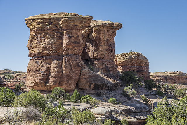
Here are a few of the remarkable rocks we saw in Canyonlands.


While driving through the park we stopped for a short hike at Pothole Point.


The surface was a large continuous dark gray rock with thousands of depressions, large and small. When there is rain, the holes fill with water and it stays long enough to support life such as tadpoles and small shrimp. A few of the now sand-filled depressions can be seen in the foreground of the above picture.


Most of the trail through this area was marked with cairns. It would have been very easy to get lost without them.


It is hard to show how large these rock cliffs are. Massive is a good adjective to use.


This is a detail I noticed. Layers within layers.


To me it is amazing how many different formations can be the result of a few forces: time, wind, water, upheavals and sinks.

On the way to and from Canyonlands we drove through about 30 miles of BLM land. "Newspaper Rock" is right along Utah 211 in the BLM.


 Petroglyphs have always fascinated me. 


These were amazingly well preserved by a huge rock overhang. 


The day itself was quite beautiful with temperatures in the 70s. I really would not want to be there when it is hotter, but I bet it would be beautiful with a dusting of winter snow. 

One last picture: