Showing posts with label Custer State Park. Show all posts

Sunday, September 6, 2015

Jewel Cave

Whenever we find ourselves in the neighborhood of a cave that is lit and has tours, we try to go there. Saturday we went to Jewel Cave National Monument which is close to Custer State Park.

We joined about thirty-five other people on the hour and twenty minute, ranger led tour. Like most ranger talks, hers was quite good and gave us a better understanding of what we were seeing. We try to read everything in the Visitor Centers, but a talk is always an added pleasure.


Taking pictures in a cave is a challenge to say the least. Especially when you are part of a tight group moving along a narrow walkways and stairs. The ranger asked us to keep moving and not stop for very long to snap pictures. I ended up with a lot of low-light images containing strange colors that had not been there to my eye. Below are a few that are pretty close to what we actually saw. All are of different formations, mostly made up of calcite. 


The last one is of a particularly interesting formation that looks just like a really huge strip of bacon. The picture we took was not in focus, so I borrowed this one from the web.


Image from the web by http://www.mendosa.com
There is another cave to the south of us, Wind Cave, that we want to visit before we move on. 

There is so much to see and do here in the Black Hills. The weather has been nice, and Blue Bell campground is very pretty even though we can't get satellite TV due to the trees.
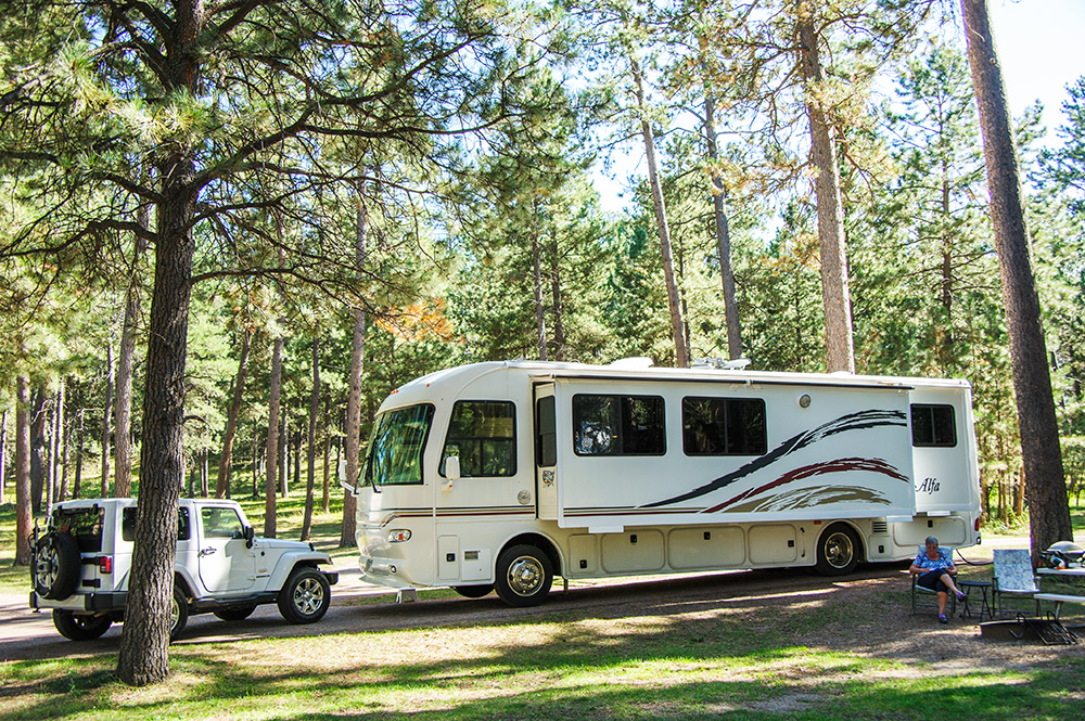


The only problem is there is no dump station in or near the campground. Since we are here for nine nights, we are about to drive thirteen miles of winding, narrow, park road to a campground with a dump station in another part of the park. We have stayed in several parks where there is no sewer hookup at our site, but there has always been one near by. We don't mind moving once a week to dump, but a 26 mile round trip is excessive!

I think we could have made it for our full stay if we used the park showers and paper plates, but Craig would rather not live like that and doesn't mind the drive. It is easier than what we drove once a week when we lived in the Alfa on our mountain property. I guess I've just gotten spoiled with all the full-hookup parks we have been at. But I really do like it here a lot better than a gravel parking lot like some of the commercial places we have stayed.  

[From Craig]  I just saw a new contributor handle on the Alfaseeya Yahoo group: "lovestheturns".  I may send him/her/them an email saying that there's a lot for them to love at Custer State Park, SD!

Thursday, September 3, 2015

Devil's Tower / Bear Lodge

[From Craig] Tuesday was an active day for us. We drove 366 miles (leap journey :-) from Medora, ND to Custer, SD with a stop at Devil's Tower, WY (tri-state leap journey) and a walk around the famous rock.

Native Americans (f.k.a. American Indians) have made pilgrimages to this place since 7000 BC. At the start of the trail around the tower, there was a sign asking us not to disturb any prayer blankets and prayer bundles we saw. Of late, our First Folk have been agitating to change the name from Devil's Tower to Bear Lodge.  

It turns out that the name "Devil's Tower" was the result of some bad translation anyway. An incompetent translator in an 1875 expedition mistook one of the Indian names for the place to mean "Bad God's Tower" which, filtered through Christian mythology, turned into "Devil's Tower". But the case for "Bear Lodge" was to my mind weakened by a sign in the Visitor Center that showed nine different names, translations from different tribal languages. Admittedly, seven of the nine names included "bear". 

The path around the rock had numerous game tracks in yellow paint crossing it. Nature Lady Merikay said most of them looked like bear tracks. I wonder how they trick the bears into walking through yellow paint before they cross the path :-)

Many European Americans and overseas visitors have visited the tower since 1977 AD, when it was featured in the science-fiction movie Close Encounters of the Third Kind. It's been since that year that we saw the film, but the hero was being prevented from contacting the (good) aliens by the US government.  

The aliens sent him dreams about Devil's Tower, where they wanted to meet non-government humans. He had no conscious recollection of the dreams until one evening when he sculpted the tower using his mashed potatoes. In person the tower gives an impression of immense mass and strength that is about as different from mashed potatoes as anything I've ever seen!

OK seriouslyEuropean Americans and overseas visitors have probably slowly increased in number since the previously mentioned 1875 expedition. In 1906, in part due to the advocacy of Teddy Roosevelt, it was made the first US National Monument.

We hiked around the tower as quickly as we could, given the number of pictures I took. The first (and thus main) photo opportunity spot had a long line, so we took this shot a little further around the trail:


Geologists have several opinions about exactly how the tower formed, but they agree that it's made of igneous-rock lava that burst up through sedimentary layers hundreds of millions of years ago. It didn't reach the surface at the time, but made a domelike bulge in the landscape. The lava cooled in ways that made it crack into columns, most of them having 6 sides as you can see above. The tower was only revealed when rains and rivers (like the nearby Belle Fourche river) eroded the soil and softer rocks away.

A little further around the trail, keen-eyed people showed us a small group of climbers who were climbing the tower. Through the magic of a 300 mm zoom lens and digital cropping, you can see two of them in the right image below. Near the top like this, the columns are less perfectly hexagonal.


Since the tower has been exposed for many millions of years, pieces have been falling off of it for that long. Some sides have larger "debris fields" than others. Here's Merikay in front of one of the largest fields of fallen rocks:


About a quarter of the way around, the lower parts of the tower changed to less-vertical columns:


Nearing halfway around, the columns change to more normal-looking rock, and develop some holes (caves?) that look large enough to live in, if you could get water and food up there:


This sign helps people know which way is the shorter, back to the parking lot:


Two thirds of the way around we came into the shadow of the tower. The distance to the tower, its height and the angle of the sun enabled a 3 PM "sunrise" as we came out of the shadow:


An hour and 45 minutes after starting the trail, we're back to the rig and ready to drive the 100 miles to Custer State Park.


The end came in time for the camp hosts to help us to our spot.


Life is good.